FROM THE SKY collection
Architecture
Architectural Guides and Maps
Urbanism and Heritage
NEW RELEASES
FROM THE SKY COLLECTION
arCHITECTURE
urbanism AND HERITAGE
ARCHITECTURAL GUIDES AND MAPS
Aerial photography is an excellent means of presenting, and providing information on, a specific city or region. It not only facilitates a wide range of readings of the reality, but carefully chosen images can also be used to produce a visual narrative of educational, cultural or tourism promotion value.
Our vast experience in aerial photography and research of interpretative images of cities and landscapes has helped us produce albums of great documental value. This ongoing project has proved to be of crucial importance in terms of sharing knowledge on and promoting cities, regions and other specific themes.
The ARCHITECTURAL GUIDES focus on the field of Architectural and Landscape Heritage, constituting a collection that is of particular value in promoting both historic and contemporary architectural heritage. The ARCHITECTURAL MAPS collection covers the 18 district capital cities of Portugal.
Each map features a timeline of the development of the respective city, including some 50 images of the most relevant buildings/constructions. The urban spaces and building complexes are described and accompanied by aerial photographs. The maps also include an alphabetical list of the designers of the referenced works.

Portugal visto do céu

porto Visto do Céu
guarda FROM THE SKY

coimbra FROM THE SKY

macao from the sky

Algarve FROM THE SKY

guimarães from the sky

azores in aerial view

LisboN FROM THE SKY

iglu

terra: forma de construir

houses and cities built with earth

terra em seminário 2007

terra em seminário 2010

Rammed earth in alentejo

arquitectura para os pobres

earth straw lime
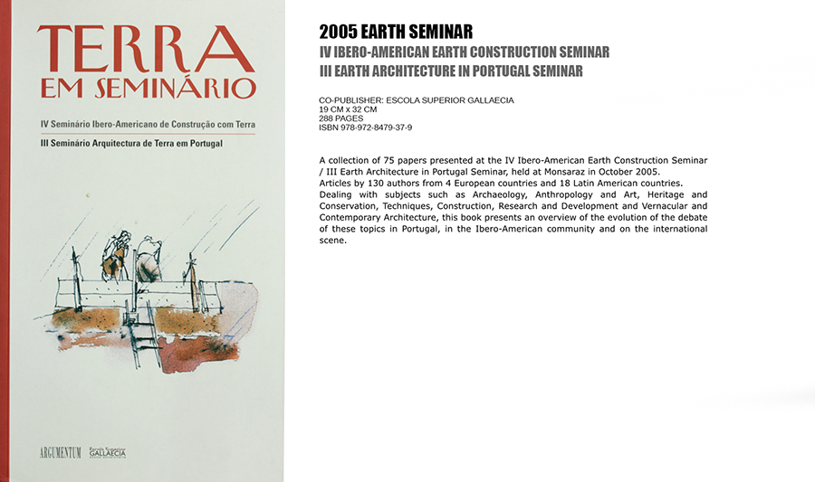
terra em seminário

o tempo e a forma

terra e casas no oeste

THE madeira archipelago lighthouses

ARQUITECTURA POPULAR DA MADEIRA

la restauraciÓn de la tapia EN LA PENÍNSULA IBÉRICA

terra incognita

art of building in yemen

EARTH architecture in portugal

Árvores e Arbustos em Portugal

Energia Solar Passiva

lisbon urban atlas

1755 the lisbon earthquake

Reabilitação Estrutural de Edifícios Antigos

Cabana

palafita
Our ARCHITECTURE series includes diverse monographs and theme-based studies and books – on Traditional Architecture, Vernacular Architecture and, in particular, Earth Architecture and Construction.
Our publication policy favours in-depth research and investigation, resulting in books of considerable scientific and cultural value.
This area encompasses wide-ranging works in the field of urban analysis and the dissemination of urban planning, as well as other important thematic and monographic works. The publications focus on both technical and historic and cultural aspects.

oporto from the sky

PORTUGAL FROM THE SKY

elementos urbanos
macau visto do céu
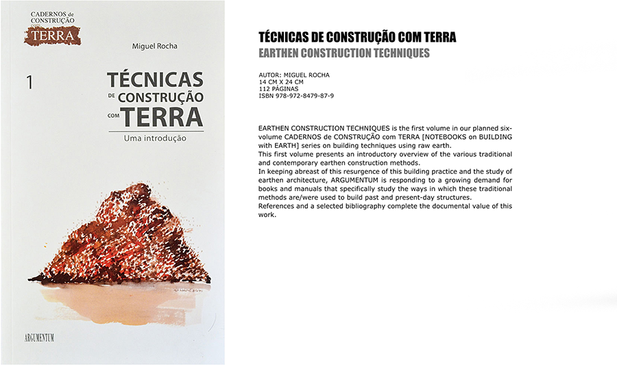
técnicas de construção com terra
Visite a Loja Online

ciUdad y democracia

gonçalo ribeiro telles

traditional architecture in the western mediterranean

arquitectura de terra em avis

lisbon, the riverside cd-rom

lisbon, the riverside


the bazaar of isfahan
arquitectura de tierra
en américa latina

PORTUGAL EM MARROCOS
Olhar sobre um património comum
Cidades Imaginadas noa Planos de Urbanização de
cabo verde, 1934/1974

terra 2012 / 12th siacot
proceedings